

Big Bend National Park with Brandy - Jan 2024
-
• ~8.5 hour drive each way
• ~1,500 miles driven
• 13.43 miles - the total distance hiked in 2 days.
• 26 degrees - the air temperature on the coldest morning with a wind chill in the teens.
• The Park covers an area of 801,163 acres.
• There are over 1,200 species of plants and over 450 species of birds in the Park.
• The Park averages around 500,000 - 600,000 visitors a year.
• The highest elevation is 7,825 feet at Emory Peak and the lowest elevation is 1,715 feet at the Rio Grand River.
• The average annual precipitation is 13.78 inches.
• Big Bend National Park was officially established as America’s 27th National Park on June 12, 1944.

Arrival - Jan 19th
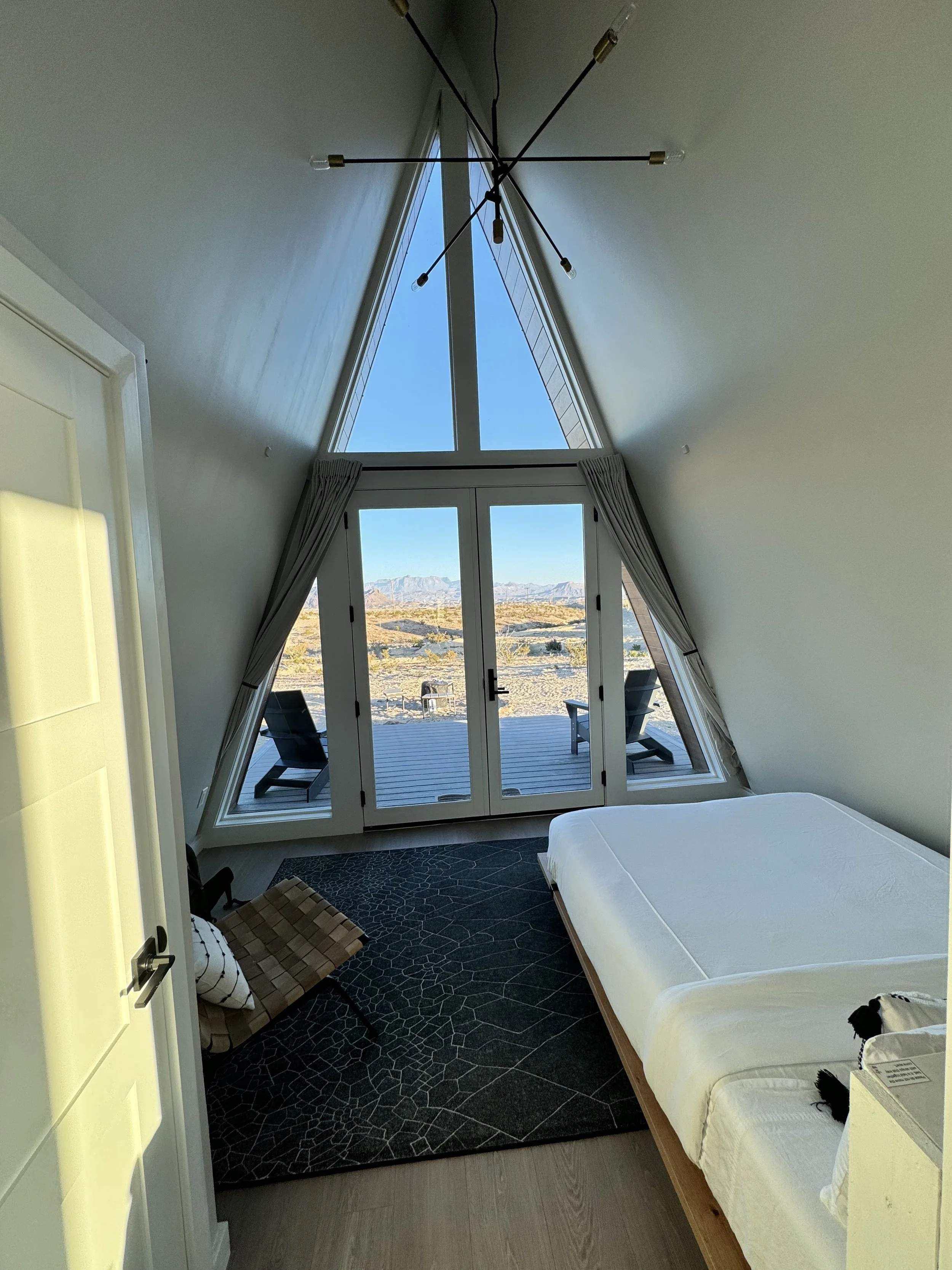
After driving a little over 9 hours, we arrived at our Airbnb around 5:30 PM. We stayed in a small A-Frame cabin full of modern amenities and a great view. There were only a few other cabins occupied and with minimal light pollution, so the night skies were fantastic - even with a near half moon.
After getting our gear unpacked we took a walk around the campsite and accidentally wandered onto a private drive with stone houses no bigger than 400 sq feet. Some of the 110 people that reside in Terlingua, TX live in these tiny homes that hardly seemed big enough for more than one person.
It was chilly with temperatures dropping into the 30s the first night, so we got a campfire going and I brought out my camera to experiment with a few photos. The moon was too bright to capture much, but I managed to get a couple photos.
Arrival Day Stats: 5,753 steps | 2.83 miles | 1,627 calories burned


Day One - Jan 20th
The first full day started off cold with air temperatures in the mid-20s and wind chills in the teens! Brandy really wanted to do a sunrise hike, but thankfully the temperatures were cold enough we decided not to do that. Instead, we headed out mid-morning to hike the Lost Mine Trail. It rises a little over 1,100 feet in 2.4 miles (one way).


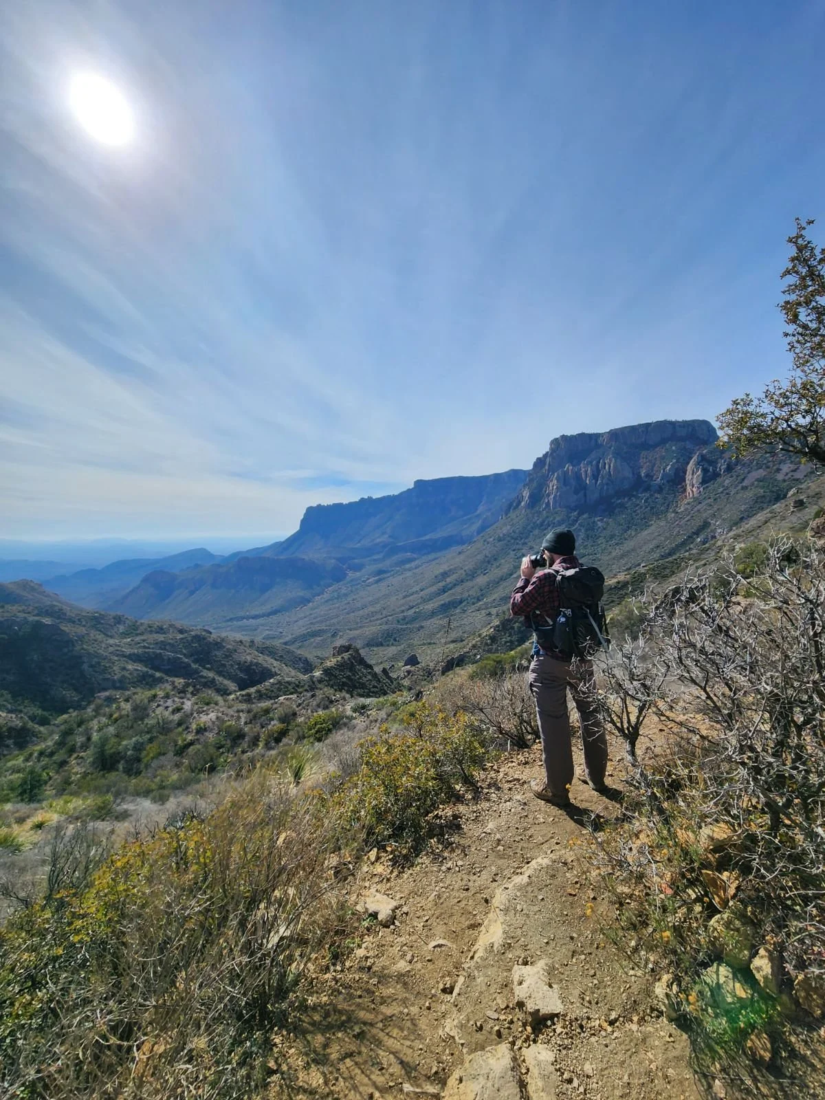
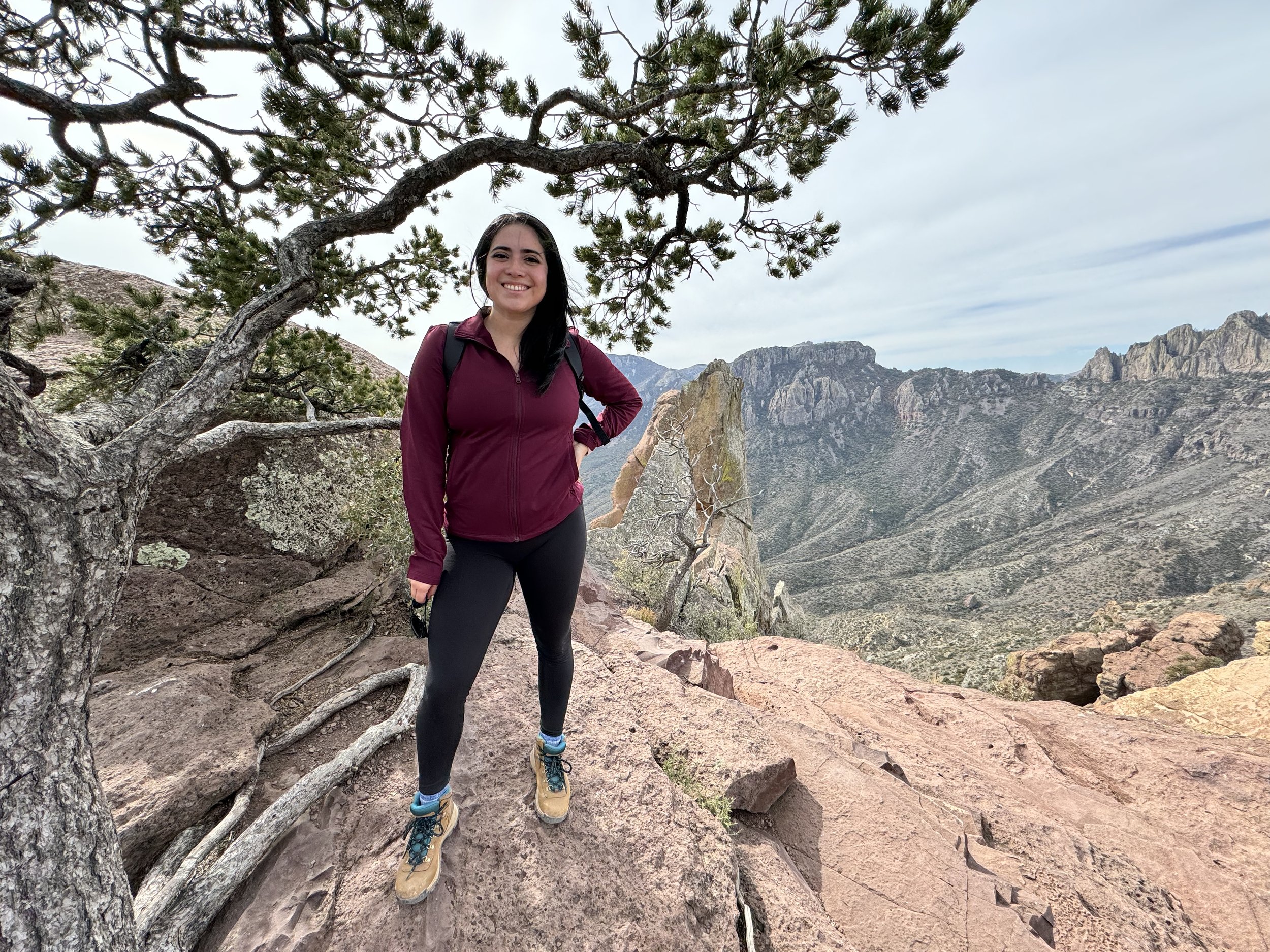
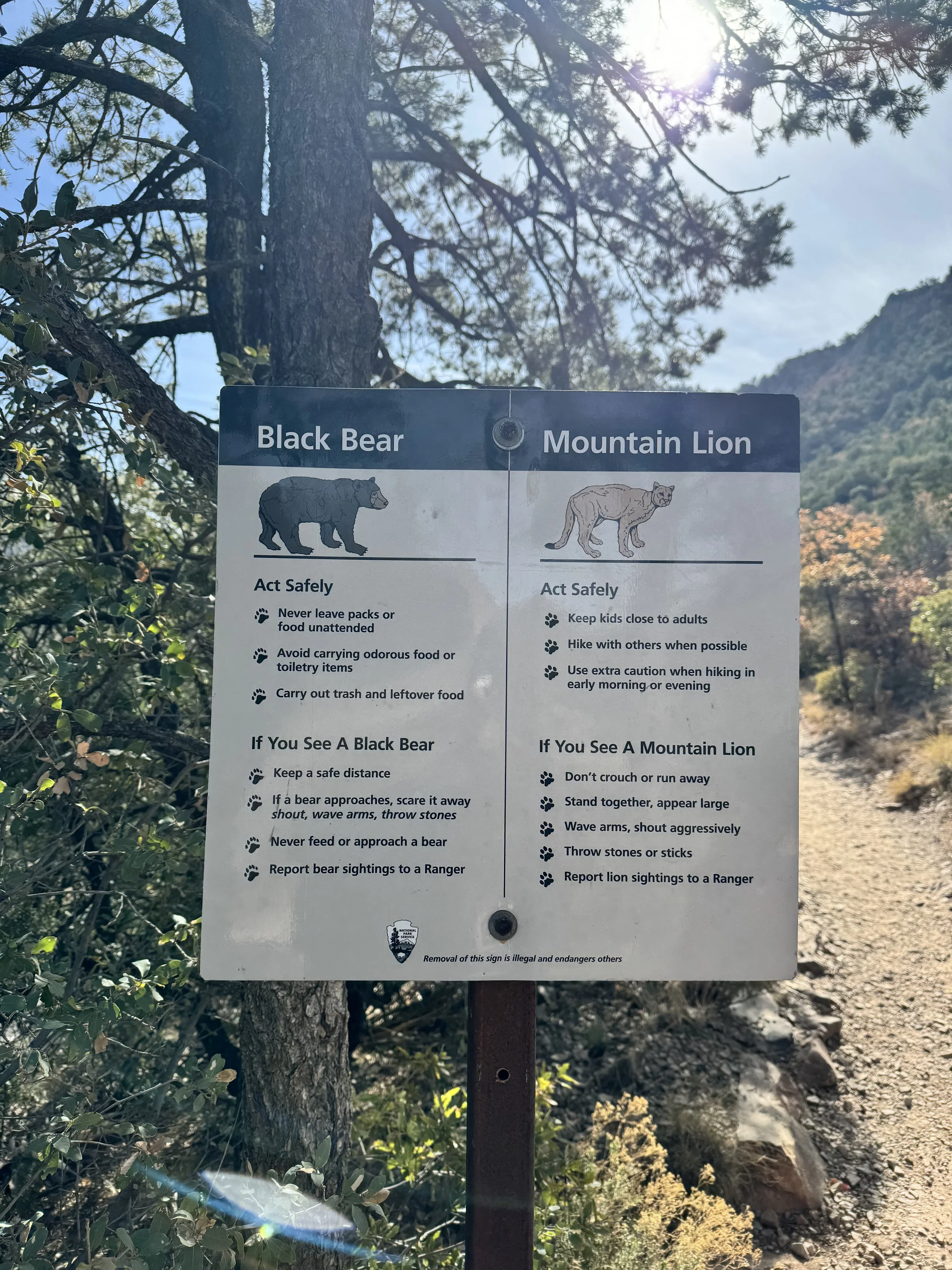
This was prime bear and mountain lion country, but unfortunately we did not see any on this hike. It was a steady uphill hike for 80% of the trail with the last 20% becoming a bit steeper with switchbacks. While we passed perhaps a few dozen people on this trail, it was one of the least busy hikes on a popular hiking trail I have ever done in a National Park.
Overall, the hike went fairly smoothly, save for two, shall we say, “incidents”. The first, right near the beginning, a couple of Youtubers approached us and asked us to help them out with something they were doing. For some reason I decided to say yes and memorized a couple lines for their video (“If you’re looking for the treasure, you won’t find any here. You’ll have to find Leroy Brown. He can help you out, but you better find him fast before he disappears for good.”) So I’ll be the star of their video and may take on a new career as a famous actor. Time will tell.
The second “incident” occurred on the way down. Not too long after Brandy said she needed to learn to trust her hiking boots and their grip, her boots failed her and she wiped out! Luckily she caught herself with her hand and only sustained a minor near puncture wound and some dirty pants. It was smooth sailing after that!
Day 1 Stats: 16,098 steps | 6.85 miles | 2,110 calories burned

Day Two - Jan 21st
Day two started off with rain, wind, and cold temperatures, but also a beautiful sunrise! We waited out the brunt of the rain before we headed to the Dog Canyon Trail later that morning. Even so, the temperature was 36 degrees with spotty showers and a steady wind, making for one chilly hike! The sun returned for the afternoon with much warmer temperatures in the 60s.


The Dog Canyon Trail is flat (only 50 feet of elevation gain) and leads to a canyon that splits the Deadhorse Mountains. The majority of the trail passes through scant desert vegetation, including creosote bush, cacti, and grasses. Once you get about 1.5 miles from the trailhead, the trail enters a normally dry wash, which is followed for the last half mile into Dog Canyon. Limestone walls quickly envelop you as you enter the canyon. But with the bitter conditions that morning, we didn’t stay too long to take in many views.
After completing the 4 mile hike, we decided to do a little off-roading on one of the roads in the Park where a high clearance, 4wd vehicle is required. The road wasn’t too bad at all, but there were a few spots you certainly needed high clearance. The terrain changed as we drove down the 5 mile long road and we eventually entered a mini-palm tree Oasis. Okay, they aren’t actually palm trees, but the Soaptree Yucca’s look a bit like a spiky palm!
Once we got back to the main road we made our way into the Chisos Basin. Here we hiked the Chisos Basin Loop Trail. This was just 1.8 miles round trip that climbs gradually through shady stands of Mexican pine, oak, and juniper with some great views of the surrounding mountains. After that we walked the Window View Trail. This is a paved 0.3 mile loop. We were getting hungry, so we headed back into town to try out one of the local restaurants and then had a roaring bonfire with smores for dessert!
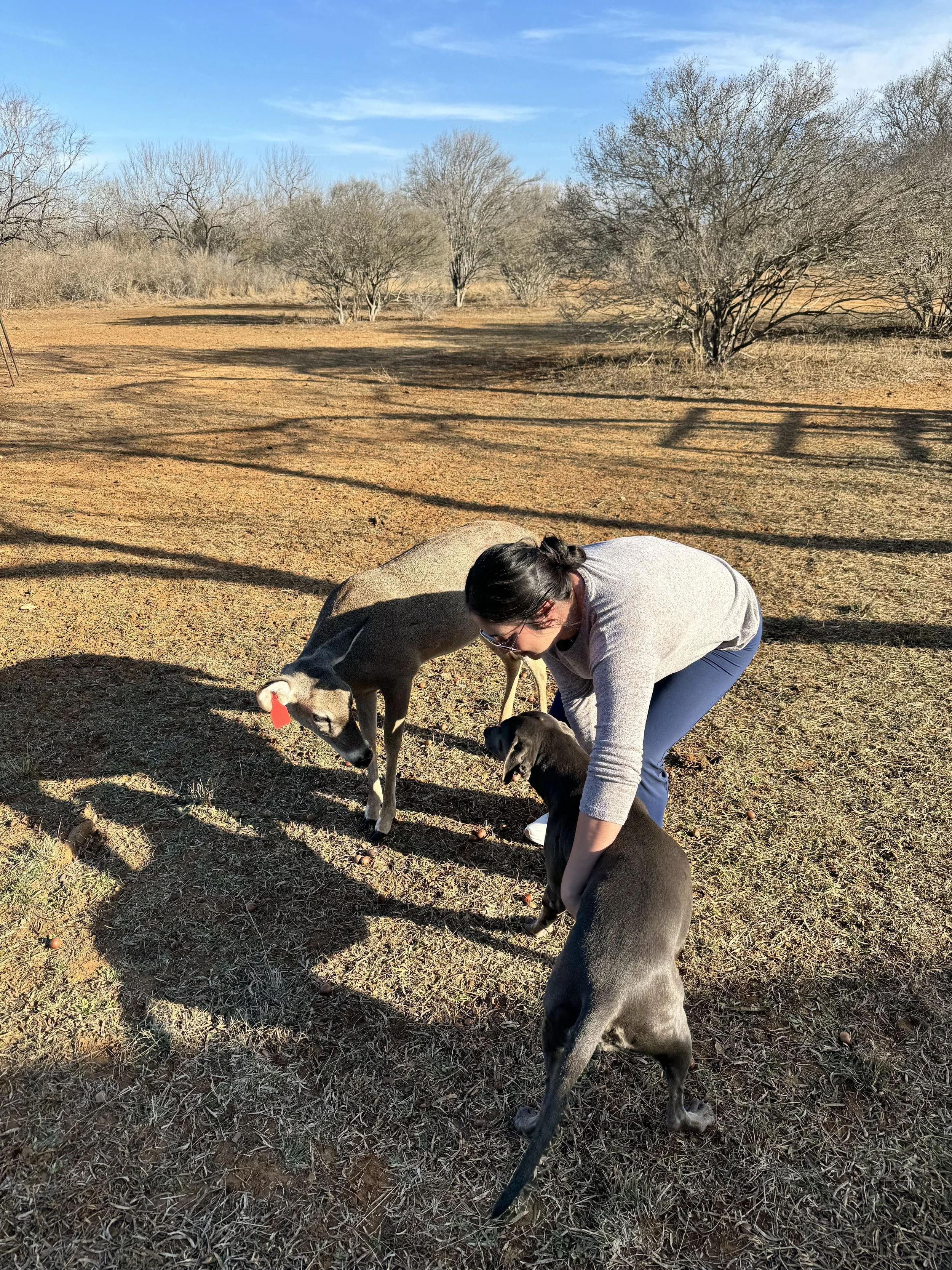
We took off for home the next morning, but we managed to stop by Jake and Sara’s on the way and Brandy got to pet her first deer and get a glimpse into the hunting world!
Day 2 Stats: 16,059 steps | 7.51 miles | 2,006 calories burned